TERRITORIAL DEVELOPMENT
Land Management
Land Management is still a great challenge in the Amazon. Predatory occupation, which destroys the forest and its ecosystems and affect the rights of local populations, is the result of not only unsustainable economic models, but absence of the State and of appropriate public policies for the use of land and their natural resources.
The Tapajós River basin, for example, one of the main logistic corridors of the country, is a hub for transporting and exporting grains. Despite the many works already underway (highways, waterways, railways and ports, other than hydropower plants and mining), there is no study on the impacts associated with these investments. Rather than proper mechanisms for consultations and compensation to the local communities, there is a new increase in deforestation, as well as land and socio-environmental conflicts. The region is one of the last frontiers of the predatory occupation process of the Amazon.
PSA actions for land management are aimed at:
- Strengthening Conservation Units where we act, assisting in their socio-economic viability and ensuring that communities feel a sense of control over their territories through sustainable socio-economic projects to counteract predatory models as well as joint efforts to access public policie;
- Supporting territories and threatened social groups that need protection and land management to maintain their environmental functions for the country and the planet, so as to ensure the rights of the populations that inhabit them;
- Participation and advocacy in the processes of planning and defining territorial scenarios and public policies for the Amazon.
The goal of all work is developing inclusive and replicable socio-environmental strategies in order to not only increase quality of life for traditional populations, but to provide demonstrable references to strengthen policies for Amazon Region Protected Areas.
Social Cartography
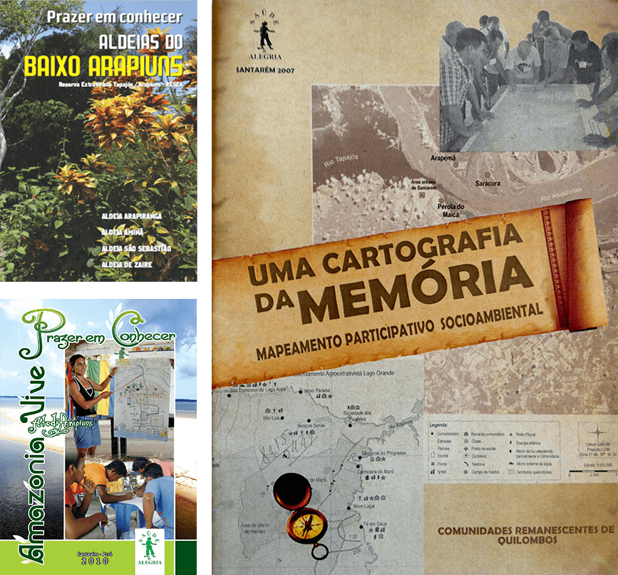
To support territorial management actions, PSA develops participatory social cartography, which is a detailed mapping of social processes – ancestral and current – of land use, with the participation of the communities themselves.
The resulting mapped documents serve as a strategic tool for these communities to better manage their own lands, promoting their social, economic and environmental development. The information gathered is essential in fighting land-grabbing and undue appropriation of natural resources, in addition to serving as a basis for land regulation and public policies aligned with the reality of the communities.
See also
Community Management
Networks and Collaboration
Dissemination and Replication of Experiences
Contact
- Av. Mendonça Furtado, 3979
- +55 93 3067-8000
- +55 93 99143-1091
- psa@saudeealegria.org.br
HOW TO HELP
Projeto Saúde & Alegria © 2020
Agência Fervo


